Seneca County, New York Property Appraiser, Search Your Record Guide
In Seneca County, New York, there are approximately 17,592 parcels. You can search property records using owner name, parcel number, or address. Enter Parcel ID (like 06504400020060000000 or SBL 65.44-2-6) to access tax details, ownership records, and complete property insights quickly.
New York Property Search
Search the public New York statewide parcel API by parcel number, owner name, or site address.
Seneca County, New York maintains accurate and updated parcel data for public access. The county tracks 17,592 parcels and around 31,227 matched buildings using multi-year aerial imagery. Address records include 19,723 secondary addresses, supporting reliable ownership, zoning, and tax assessment systems. Data sources were refreshed on 2024-03-26, ensuring high-quality property insights for users and real estate research.
Total Residential Properties
12,697
Total Commercial Properties
1,062
Avg. Home Age
Avg. Square Feet
Total Residential Sales 2026
47
Homes Seriously Underwater
0.95%
Residential Sales 2025 year
356
Equit Rich Homes
24.33%
Effective 2026 Property Tax
Total Foreclosure Filings
1
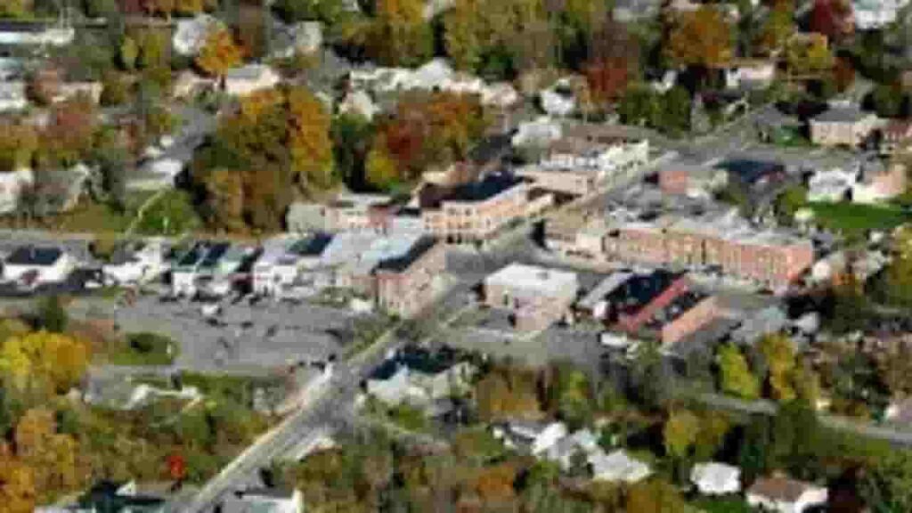
Seneca County GIS Map and Overview
Seneca County, New York covers roughly 391 square miles, including both land and water areas. The region features lakeside geography and stable housing trends. Median home values remain moderate, supporting balanced real estate growth and investment opportunities across mapped parcel boundaries.
- Total Area: 391 sq. miles
- Land Area: 325 sq. miles
- Water Area: 66 sq. miles
- Median Home Value: $180,000
- Population: 33,000
Nearby Counties
Famous Cities In Seneca County
Waterloo
4,000 Parcels

Ovid
1,375 parcels

4,189 Parcels
Seneca County Property Search Tool Has 4 Best Methods
Our Seneca County, New York property search tool allows fast and free access to real estate records. Search using owner name, parcel ID, property address, or city name. Instantly view ownership history, tax data, valuation, and complete parcel details with user-friendly access.
Search By Owner Name
Search property records using the owner’s full name to locate ownership data and linked parcels. This method in Seneca County, New York helps verify legal ownership, track multiple properties, and access detailed tax and assessment records efficiently.
Search By Address
Enter a complete property address to retrieve parcel-level data, including ownership, valuation, and tax details. Address-based lookup in Seneca County, New York ensures quick identification of specific properties and accurate geographic placement within county records.
Search By Parcel PIN
Use the Parcel Identification Number (PIN) for precise and direct property record access. This method eliminates errors and provides exact results within Seneca County, New York, including ownership history, tax assessments, and structural property data.
Search By City Name
If limited details are available, search using city names like Waterloo or Seneca Falls. This method helps narrow down results across Seneca County, New York, making it easier to browse properties within a specific locality or jurisdiction.
Seneca County Property Search Tool Provides Information
Our Seneca County, New York property lookup system delivers complete property insights. Users can access ownership data, parcel values, tax records, land details, and assessment history. The tool ensures reliable, fast, and structured property research for buyers, investors, and analysts.
Parcel PIN
A parcel PIN is a unique numeric identifier assigned to each property in Seneca County, New York. It allows precise record tracking across tax systems, GIS maps, and assessment databases. This identifier ensures accurate search results and eliminates confusion between similar property records.
Owner Address
The owner address represents the official mailing or residential location of the registered property owner. In many Seneca County, New York records, this may differ from the property site, helping identify off-site owners or investment property holders clearly.
Administration Code
The administration code is used internally by county systems to classify and manage parcels. In Seneca County, New York, it supports data organization, taxation categories, and processing workflows, ensuring each parcel is handled correctly within government databases and property systems.
Owner Identity
Zoning codes define permitted land use, such as residential or industrial. In Seneca County, New York, zoning information helps property owners understand development limits, building regulations, and land-use planning guidelines enforced by local authorities.
Legal Identification
Legal identification includes the official property description recorded in deeds. It defines boundaries, lot numbers, and survey details. In Seneca County, New York, this ensures precise legal recognition of parcels for transactions, disputes, and property documentation.
Tax Parcel Use Code
Tax parcel use codes classify properties into categories like residential, commercial, or agricultural. These codes in Seneca County, New York determine tax rates, assessment methods, and regulatory compliance based on how the property is officially used.
Zoning Code
Zoning codes define permitted land use, such as residential or industrial. In Seneca County, New York, zoning information helps property owners understand development limits, building regulations, and land-use planning guidelines enforced by local authorities.
GIS Acres
GIS acres represent property size calculated using geographic mapping systems. In Seneca County, New York, this data provides accurate land measurements, helping buyers, investors, and planners evaluate parcel dimensions and spatial boundaries effectively.
Construction Date
The construction date indicates when the main structure was built. In Seneca County, New York, this helps estimate building age, depreciation, and renovation needs, offering valuable insights for buyers, appraisers, and property investors.
Gross Living Area
Gross living area measures the total finished interior space of a residential property. In Seneca County, New York, this metric is essential for valuation, comparison, and determining overall usability of a property’s living space.
Building Code
Building codes identify structural classifications and compliance standards. In Seneca County, New York, these codes ensure properties meet safety, design, and construction regulations, supporting proper evaluation and inspection processes.
Water Supply
Water supply data shows whether a property uses public water or private systems like wells. In Seneca County, New York, this information is important for utility planning, property valuation, and determining service availability.
Sewerage System
The sewerage system indicates how wastewater is managed, either through public sewer lines or private septic systems. In Seneca County, New York, this affects property usability, maintenance requirements, and environmental compliance.
Property Valuation Date
Property valuation data breaks down land and improvement values separately. In Seneca County, New York, it helps users understand how total assessments are calculated and supports transparent tax evaluation processes.
Net Assessed Land Value
Net assessed land value represents the taxable value of land after adjustments. In Seneca County, New York, it is used directly in tax calculations and reflects the official land worth determined by assessors.
Full Site Address
The full site address provides the exact physical location of the parcel. In Seneca County, New York, it includes street name, number, and locality, helping users easily locate and verify properties within official county mapping systems.
Mailing Address
The mailing address shows where tax bills and official notices are sent. In Seneca County, New York, this may differ from the site address, especially for rental or investment properties owned by non-residents.
Site Address Zip
The ZIP code identifies the postal region of a property location. In Seneca County, New York, it ensures accurate mail delivery, supports location verification, and improves search precision within property record systems.
Schuyler County, NY Property Tax & Community Data
Detailed property and taxation overview for communities within Schuyler County, New York. This dataset highlights estimated parcel counts, population figures, land area, uniform millage rates, and median property tax values to support real estate and tax analysis.
| City / Community Name | Total Parcels (Est.) | Total Population (2026) | Area (Sq Mi) | Preliminary Millage Rate (2026) | Median Tax Bill (Est.) |
|---|---|---|---|---|---|
| Hector (Town) | ~4,800 | 4,604 | 102.0 | 4.49 | $3,450 |
| Dix (Town) | ~2,500 | 3,392 | 36.0 | 4.49 | $3,210 |
| Montour (Town) | ~1,600 | 2,112 | 19.0 | 4.49 | $3,180 |
| Watkins Glen (Village) | ~1,100 | 1,691 | 2.0 | 4.49 | $3,650 |
| Reading (Town) | ~1,450 | 1,627 | 27.0 | 4.49 | $3,850 |
| Tyrone (Town) | ~1,550 | 1,510 | 37.0 | 4.49 | $2,980 |
| Catharine (Town) | ~1,300 | 1,472 | 32.0 | 4.49 | $3,050 |
| Montour Falls (Village) | ~950 | 1,465 | 3.0 | 4.49 | $3,120 |
| Orange (Town) | ~1,150 | 1,309 | 54.0 | 4.49 | $2,740 |
| Cayuta (Town) | ~550 | 445 | 20.0 | 4.49 | $2,580 |
| Odessa (Village) | ~450 | 506 | 1.0 | 4.49 | $2,950 |
| Burdett (Village) | ~350 | 311 | 1.0 | 4.49 | $2,840 |
FAQs
How can I do a Seneca County NY property search by owner name?
You can search property records by owner name through official county assessment databases or third-party public record websites. These tools allow you to enter a person’s name and retrieve ownership details, tax history, and parcel data.
What is Seneca County ImageMate Property Search?
ImageMate is a GIS-based property lookup system commonly used in New York counties to view parcel data, ownership details, and tax information. In some counties, older ImageMate systems may be discontinued or replaced with updated portals, so users should check the official county website for the latest access point.
Can I search Seneca County property records by address?
Yes, you can perform a property search using a street address. This method typically provides details such as property ownership, assessed value, sales history, and tax records. Many platforms allow direct address input for quick and accurate lookup results.
Is there a free Seneca County NY property search available?
Yes, several platforms offer free access to Seneca County property records, including tax assessments, deeds, and GIS maps. However, some tools may limit the number of daily searches or require registration for advanced features.
Does Seneca County provide a GIS map for property search?
Yes, Seneca County provides GIS mapping resources that allow users to explore parcel boundaries, land data, and geographic details. These maps help visualize property locations, zoning, and land features, making them useful for buyers, investors, and researchers.