Nassau County Property Appraiser, Search Your Record Lookup
In Nassau County New York, there are 407,612 parcels available. You can search property records using parcel number, owner name, or address. Enter Parcel ID (like 06504400020060000000 or SBL 65.44-2-6) to access ownership, tax, and property details easily.
New York Property Search
Search the public New York statewide parcel API by parcel number, owner name, or site address.
The local property assessment office maintains accurate and updated parcel data for public access. The system includes 407,612 parcels and 517,049 matched buildings, supported by multi-year aerial imagery datasets. Address databases include 555,976 secondary addresses, improving record matching and verification. Zoning data is standardized for 228,042 parcels, ensuring reliable land-use classification and valuation. Updated address records were refreshed on 2026-01-01, while zoning datasets were last updated on 2024-08-09, supporting transparent tax roll and property assessments.
Total Residential Properties
378,860
Total Commercial Properties
16,829
Avg. Home Age
Avg. Square Feet
Total Residential Sales 2026
1,471
Homes Seriously Underwater
0.28%
Residential Sales 2025 year
9,069
Equit Rich Homes
47.64%
Effective 2026 Property Tax
Total Foreclosure Filings
270
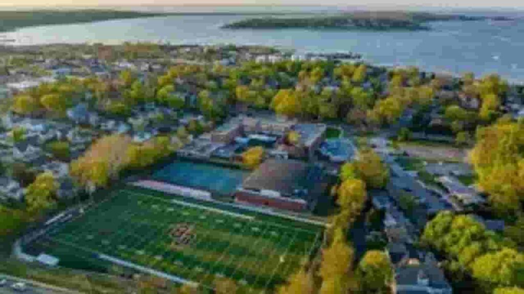
GIS Map and County Overview
This region in New York covers approximately 453 square miles, including about 285 square miles of land and 168 square miles of water. The total population is estimated at 1,395,774, based on recent census data and growth trends. Interactive GIS maps help users explore parcel boundaries, zoning layers, ownership data, and geographic features for better real estate insights and planning decisions.
- Total Area: about 453 sq. miles
- Land Area: about 285 sq. miles
- Water Area: about 168 sq. miles
- Median Home Value: about $650,000
- Population: about 1,395,774
Nearby Counties
Famous Cities in Nassau County

Port Washington
8,965 Parcels
Oyster Bay
3,093 parcels

2,564 Parcels
Nassau County NY Property Search Latest Tool
Our advanced property lookup tool allows fast and free access to detailed records. Users can retrieve ownership, tax, and parcel data within seconds using simple search options.
Search By Owner Name
Find property ownership details by entering a person’s name. This method helps identify assets, verify ownership, and explore related real estate records across Nassau County datasets quickly and accurately.
Search By Address
Enter a complete street address to access detailed parcel data. This includes ownership records, tax details, zoning classification, and structural information for accurate property identification and research purposes.
Search By Parcel PIN
Use a unique parcel identification number to locate exact records. This method ensures precise search results, helping users quickly access tax data, ownership history, and legal property information.
Search By City Name
If full details are unavailable, search using a city name. This helps filter property results by location, making it easier to browse available records and identify relevant parcels efficiently.
Nassua County NY Property Search Tool Provides Complete Information
This property lookup system delivers detailed insights for each parcel. Users can access ownership records, tax data, zoning details, land values, and official assessment information to support real estate research, investment decisions, and legal verification.
Parcel PIN
A parcel identification number is a unique code assigned to each property within Nassau County systems. It enables fast record retrieval, helping users locate ownership data, tax details, legal descriptions, and assessment information accurately and efficiently.
Owner Address
The owner address represents the registered mailing location of the property owner. It is used for official communication, including tax notices and legal documents, helping verify ownership and ensure proper delivery of important correspondence records.
Administration Code
Administrative codes are internal identifiers used to organize and manage property records. These codes help streamline database operations, ensuring consistent data handling, accurate classification, and efficient tracking of parcels across county systems and departments.
Owner Identity
Owner identity confirms the legally recognized individual or entity holding property rights. This section helps users verify ownership status, review recorded names, and ensure transparency in real estate transactions and official documentation records.
Legal Identification
Legal identification provides the official description of a property’s boundaries and location. It is used in deeds, transfers, and legal filings, ensuring accurate property recognition and supporting dispute resolution and ownership verification processes.
Tax Parcel Use Code
These codes classify property based on usage type, such as residential, commercial, or mixed-use. They help determine applicable tax rates and provide insight into how a property is officially categorized within local taxation systems.
Zoning Code
Zoning codes define permitted land use and development regulations. They guide residential, commercial, and industrial planning, helping property owners understand restrictions, building rules, and future development possibilities within designated zoning districts.
GIS Acres
GIS acres represent the total land size calculated through geographic information systems. This measurement provides precise parcel area data, helping with planning, valuation, and understanding the physical dimensions of a property.
Construction Date
Construction date indicates the year when the primary structure was built. This information helps estimate property age, assess structural condition, and understand depreciation factors affecting overall property value and maintenance requirements.
Gross Living Area
Gross living area measures the total enclosed residential space within a property. It is a key factor in determining market value, comparing properties, and evaluating living space for buyers, sellers, and real estate professionals.
Building Code
Building codes classify construction type and structural design. These codes ensure compliance with safety standards and help identify building characteristics, materials, and regulatory requirements for property development and maintenance.
Water Supply
Water supply details indicate whether a property is connected to a public system or uses a private source like a well. This information is important for utility planning, property valuation, and residential usability assessments.
Sewerage System
The sewerage system defines how wastewater is managed, whether through public sewer lines or private septic systems. It ensures environmental compliance and helps users understand infrastructure availability and maintenance requirements for properties.
Property Valuation Date
Property valuation data includes assessed values for land and structures. It supports tax calculations, market analysis, and investment decisions, offering a detailed breakdown of how total property value is determined by assessment authorities.
Net Assessed Land Value
Net assessed land value represents the taxable value of land after exemptions or adjustments. It plays a key role in property tax calculations, helping determine final tax liability for property owners.
Full Site Address
The full site address provides the exact physical location of a property. It includes street details and geographic identifiers, ensuring accurate identification for mapping, legal documentation, and property record searches.
Mailing Address
The mailing address is where official notices and tax bills are sent. It may differ from the property location, especially for investors or absentee owners, ensuring proper communication and document delivery.
Site Address Zip
The ZIP code identifies the postal region associated with a property. It improves search accuracy, supports geographic classification, and ensures efficient mail delivery and correct regional identification within property record systems.
Nassau County, NY Property Tax & Community Data
Community-level property and tax insights across Nassau County, New York. This dataset includes estimated parcels, population, land area, preliminary millage rates, and median property tax bills to support property research and real estate analysis.
| City / Community Name | Parent Municipality | Total Parcels (Est.) | Total Population (2026) | Area (Sq Mi) | Preliminary Millage Rate (2026) | Median Tax Bill (Est.) |
|---|---|---|---|---|---|---|
| Albertson | Town of North Hempstead | 2,150 | 5,200 | 0.70 | 3.45 | $3,532 |
| Atlantic Beach | Town of Hempstead | 1,220 | 1,750 | 0.40 | 4.10 | $6,160 |
| Baldwin | Town of Hempstead | 11,400 | 33,500 | 3.00 | 4.85 | $3,344 |
| Bayville | Town of Oyster Bay | 2,850 | 6,700 | 1.40 | 4.20 | $3,342 |
| Bellmore | Town of Hempstead | 6,800 | 16,100 | 2.50 | 4.40 | $3,407 |
| Bethpage | Town of Oyster Bay | 5,950 | 16,800 | 3.60 | 4.15 | $3,074 |
| Carle Place | Town of North Hempstead | 1,850 | 5,100 | 0.90 | 3.90 | $3,320 |
| Cedarhurst | Town of Hempstead | 2,100 | 6,800 | 0.70 | 4.35 | $5,295 |
| East Meadow | Town of Hempstead | 12,400 | 38,100 | 4.40 | 4.60 | $3,578 |
| East Norwich | Town of Oyster Bay | 1,150 | 2,800 | 1.10 | 3.80 | $3,445 |
| East Rockaway | Town of Hempstead | 3,450 | 10,200 | 1.00 | 4.70 | $3,362 |
| Elmont | Town of Hempstead | 10,200 | 35,600 | 3.40 | 4.95 | $3,465 |
| Floral Park | Town of Hempstead | 5,100 | 16,200 | 1.40 | 4.10 | $3,284 |
| Franklin Square | Town of Hempstead | 8,900 | 29,800 | 2.90 | 4.40 | $3,410 |
| Freeport | Town of Hempstead | 12,800 | 44,100 | 4.60 | 5.10 | $3,238 |
| Garden City | Town of Hempstead | 7,650 | 22,800 | 5.30 | 3.85 | $4,730 |
| Glen Cove | City of Glen Cove | 8,400 | 28,100 | 6.70 | 8.45 | $6,784 |
| Glen Head | Town of Oyster Bay | 1,480 | 4,950 | 1.60 | 3.75 | $5,351 |
| Glenwood Landing | Town of Oyster Bay | 650 | 3,850 | 1.00 | 3.75 | $3,133 |
| Great Neck | Town of North Hempstead | 10,400 | 10,100 | 1.40 | 4.25 | $6,685 |
| Greenvale | Town of North Hempstead | 450 | 2,100 | 0.30 | 3.60 | $3,902 |
| Hempstead | Town of Hempstead | 13,850 | 59,500 | 3.70 | 5.40 | $3,439 |
| Hewlett | Town of Hempstead | 2,450 | 7,200 | 0.90 | 4.40 | $4,302 |
| Hicksville | Town of Oyster Bay | 13,200 | 43,500 | 6.80 | 4.10 | $3,028 |
| Inwood | Town of Hempstead | 2,150 | 9,800 | 1.70 | 4.95 | $3,762 |
| Island Park | Town of Hempstead | 1,950 | 4,850 | 0.50 | 5.20 | $3,690 |
| Jericho | Town of Oyster Bay | 4,200 | 14,200 | 4.10 | 3.55 | $4,355 |
| Lawrence | Town of Hempstead | 2,100 | 6,500 | 1.20 | 4.15 | $9,339 |
| Levittown | Town of Hempstead | 16,400 | 52,100 | 6.90 | 4.40 | $2,997 |
| Locust Valley | Town of Oyster Bay | 1,320 | 3,500 | 0.90 | 3.80 | $4,558 |
| Long Beach | City of Long Beach | 11,200 | 34,200 | 2.10 | 9.15 | $7,677 |
| Lynbrook | Town of Hempstead | 6,400 | 20,400 | 2.00 | 4.60 | $3,439 |
| Malverne | Town of Hempstead | 2,850 | 8,600 | 1.10 | 4.45 | $3,453 |
| Manhasset | Town of North Hempstead | 5,800 | 8,200 | 2.40 | 3.40 | $6,949 |
| Massapequa | Town of Oyster Bay | 14,500 | 21,800 | 4.00 | 4.30 | $3,315 |
| Massapequa Park | Town of Oyster Bay | 5,950 | 17,200 | 2.20 | 4.30 | $3,184 |
| Merrick | Town of Hempstead | 8,400 | 21,500 | 5.20 | 4.40 | $3,679 |
| Mill Neck | Town of Oyster Bay | 480 | 1,050 | 2.60 | 3.50 | $7,634 |
| Mineola | Town of North Hempstead | 5,100 | 20,800 | 1.30 | 4.25 | $3,264 |
| New Hyde Park | Town of North Hempstead | 8,400 | 10,200 | 0.80 | 3.95 | $3,588 |
| Oceanside | Town of Hempstead | 11,400 | 32,500 | 5.40 | 4.55 | $3,382 |
| Old Bethpage | Town of Oyster Bay | 1,850 | 5,500 | 4.10 | 4.15 | $4,101 |
| Old Westbury | Town of North Hempstead | 1,120 | 4,650 | 8.60 | 3.25 | $8,805 |
| Oyster Bay | Town of Oyster Bay | 3,120 | 7,100 | 1.60 | 3.80 | $5,388 |
| Plainview | Town of Oyster Bay | 9,800 | 27,200 | 5.70 | 4.15 | $3,748 |
| Point Lookout | Town of Hempstead | 620 | 1,250 | 0.20 | 5.30 | $6,857 |
| Port Washington | Town of North Hempstead | 5,450 | 16,200 | 5.60 | 3.55 | $4,568 |
| Rockville Centre | Town of Hempstead | 8,900 | 26,100 | 3.40 | 4.45 | $4,351 |
| Roosevelt | Town of Hempstead | 4,200 | 16,800 | 1.10 | 5.60 | $3,460 |
| Roslyn | Town of North Hempstead | 1,150 | 2,900 | 0.60 | 3.70 | $5,936 |
| Roslyn Heights | Town of North Hempstead | 2,150 | 6,800 | 1.50 | 3.70 | $5,001 |
| Sea Cliff | Town of Oyster Bay | 1,820 | 5,100 | 1.10 | 3.75 | $3,827 |
| Seaford | Town of Hempstead | 5,120 | 15,500 | 2.60 | 4.40 | $3,309 |
| Syosset | Town of Oyster Bay | 6,450 | 19,200 | 5.00 | 3.65 | $3,981 |
| Uniondale | Town of Hempstead | 6,800 | 24,100 | 2.70 | 5.10 | $3,178 |
| Valley Stream | Town of Hempstead | 12,400 | 37,800 | 3.50 | 5.10 | $3,714 |
| Wantagh | Town of Hempstead | 6,250 | 18,900 | 4.10 | 4.40 | $3,370 |
| West Hempstead | Town of Hempstead | 6,100 | 20,200 | 2.80 | 4.65 | $3,512 |
| Westbury | Town of North Hempstead | 5,120 | 15,800 | 2.40 | 4.25 | $3,204 |
| Williston Park | Town of North Hempstead | 2,450 | 7,600 | 0.60 | 3.85 | $3,499 |
| Woodbury | Town of Oyster Bay | 3,120 | 9,200 | 5.10 | 3.65 | $5,365 |
| Woodmere | Town of Hempstead | 5,450 | 17,600 | 2.70 | 4.40 | $5,685 |
FAQs
How can I perform Nassau County New York property search by name?
You can access basic property records in Albany County, New York through official county portals and assessment databases. Searches are available by owner name, parcel ID, or address, while some advanced records or document copies may require small fees.
How does Nassau County property owner search work?
A Nassau County property owner search allows users to find property records using an individual or business name. The system returns ownership details, parcel identification numbers, site address, tax assessments, and related real estate information for verification.
Can I do Nassau County property search by address online?
Yes, Nassau County property search by address is available through online GIS and real property tools. Enter the full address to access parcel maps, ownership records, zoning information, tax details, and building data quickly and accurately.
Is there a Nassau County New York property search map available?
Yes, the Nassau County New York property search map provides an interactive GIS platform. Users can view parcel boundaries, land use, ownership layers, and location data, making property identification and geographic analysis easier for research and planning.
How can I do New York property owner search free and Nassau County deed search?
You can perform a New York property owner search free and Nassau County deed search through county clerk or real property portals. These tools provide deed records, ownership transfers, tax data, and legal property documents for public access.