Franklin County NY Property Appraiser, Tax Record Search
In Franklin County, New York, there are 34,387 parcels available for public search. You can find property records using parcel ID, owner name, or address. Enter Parcel PIN without spaces (like 06504400020060000000 or SBL 65.44-2-6) to access tax, ownership, and full property details instantly.
New York Property Search
Search the public New York statewide parcel API by parcel number, owner name, or site address.
Franklin County, NY property appraiser office maintains updated parcel records for public access. The system tracks 34,387 parcels and 48,708 matched buildings using verified GIS and aerial imagery sources. Recent updates include 33,699 secondary addresses, improving location accuracy. Address data was refreshed on 2026-01-01. Imagery sources range from 2015 to 2022, ensuring reliable mapping. Zoning and land classification data are structured to support accurate property valuation, tax assessments, and ownership verification across the county database.
Total Residential Properties
20,056
Total Commercial Properties
1,292
Avg. Home Age
Avg. Square Feet
Total Residential Sales 2026
98
Homes Seriously Underwater
0.65%
Residential Sales 2025 year
826
Equit Rich Homes
17.31%
Effective 2026 Property Tax
Total Foreclosure Filings
2
Franklin County GIS Map and Overview
Franklin County, NY spans a large geographic area with diverse land coverage. GIS mapping provides detailed parcel visualization, property boundaries, and land usage insights for residents and investors.
- Total area: approx. 1,697 square miles
- Land area: approx. 1,629 square miles
- Water area: approx. 68 square miles
- Median home value: approx. $160,000
- Population: approx. 47,555 (2020 Census)
Nearby Counties
Top Cities in Franklin County
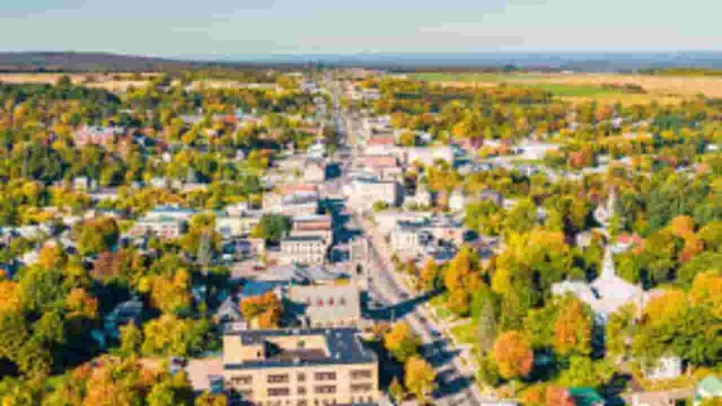
Malone
4,895 Parcels

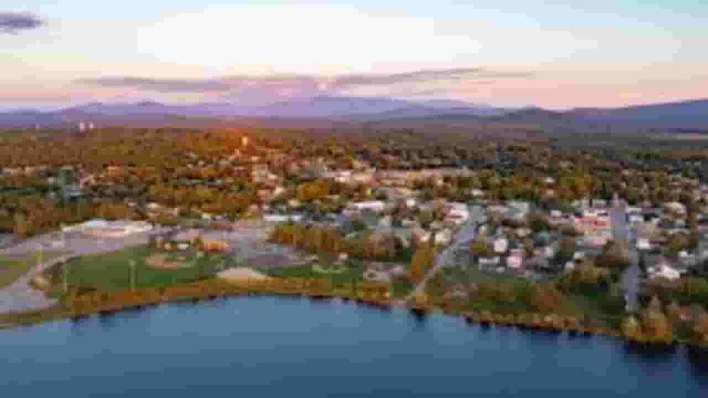
Saranac Lake
3,461 parcels
3,222 Parcels
Franklin County NY Property Search Tool Easy Methods
The Franklin County property lookup tool helps users access real estate data online without cost. It allows fast searches using multiple criteria, delivering ownership, tax, and parcel insights within seconds.
Search By Owner Name
Users can search Franklin County NY property records using the owner’s full or partial name. This method helps identify ownership details, linked parcels, and property-related records stored in county databases.
Search By Address
Entering a complete property address allows users to quickly locate parcel details in Franklin County. This method returns ownership data, structural details, tax records, and accurate property location insights instantly.
Search By Parcel PIN
Parcel Identification Number search provides the most accurate way to find specific records. In Franklin County systems, each PIN links directly to property details, tax data, ownership history, and valuation records.
Search By City Name
If exact details are unavailable, users can search using city names within Franklin County. This helps narrow down property results and identify parcels located within specific municipal boundaries or regions.
Franklin County NY Property Search Tool Data Insights
The Franklin County NY property search platform delivers complete real estate information. Users can access ownership data, parcel details, land values, tax records, zoning information, and official assessment reports for better decision-making.
Parcel PIN
Each parcel in Franklin County is assigned a unique identification number for tracking purposes. This code helps users quickly locate property records, verify ownership details, and access tax information within official county databases.
Owner Address
The recorded property address shows the exact physical location of the parcel within Franklin County. It includes street details and geographic identifiers, allowing users to easily recognize and confirm the property’s location.
Administration Code
Administrative codes in Franklin County systems categorize parcels for internal management and record organization. These codes assist in processing tax data, maintaining records, and ensuring consistency across property assessment and reporting systems.
Owner Identity
This section displays the legally registered owner listed in Franklin County records. It helps confirm property ownership, verify legal rights, and identify individuals or entities responsible for the parcel.
Legal Identification
Legal descriptions define the property boundaries using official recorded language. In Franklin County, this ensures precise identification of land parcels for ownership verification, legal transactions, and accurate documentation purposes.
Tax Parcel Use Code
Use codes classify properties based on usage such as residential, commercial, or agricultural. Franklin County assigns these codes to support proper tax calculation and help users understand property classification.
Zoning Code
Zoning information in Franklin County determines how land can be used or developed. It helps property owners and investors understand restrictions, permitted uses, and planning regulations associated with each parcel.
GIS Acres
GIS acreage represents the calculated land size using geographic mapping systems. Franklin County mapping tools provide accurate measurements, helping users understand property dimensions and total land coverage clearly.
Construction Date
This field shows the year the primary structure was built. In Franklin County records, it helps estimate property age, structural condition, and potential renovation or maintenance requirements.
Gross Living Area
Gross living area indicates the total usable interior space of a property. Franklin County data includes this measurement to help evaluate residential size, functionality, and overall property value.
Building Code
Building codes classify the type and structure of improvements on a parcel. Franklin County uses these codes to identify construction styles, materials, and building categories for accurate assessment and compliance.
Water Supply
Water supply data identifies the source of water for the property, such as public systems or private wells. Franklin County records help users understand utility availability and infrastructure connections.
Sewerage System
Sewer system information shows how waste is managed on the property. Franklin County may list public sewer connections or private septic systems, helping assess sanitation and utility setup.
Property Valuation Date
Valuation data separates land and improvement values for accurate assessment. Franklin County uses this information to calculate taxes and provide transparent property worth estimates based on official records.
Net Assessed Land Value
This value represents the assessed worth of land excluding structures. Franklin County calculates this figure to determine base taxation and evaluate land value independently from property improvements.
Full Site Address
The complete site address identifies the exact location of the parcel within Franklin County. It includes street, city, and geographic markers, helping users easily locate and verify the property.
Mailing Address
Mailing address indicates where official notices and tax documents are sent. In Franklin County, this address may differ from the physical site location depending on owner preferences or record details.
Site Address Zip
ZIP code information defines the postal region of the property. Franklin County records use this detail to improve search accuracy, verify location data, and ensure correct delivery of official correspondence.
Franklin County, NY Property Tax & Community Data
Community-level property and tax insights across Franklin County, New York. This dataset includes estimated parcels, population, land area, preliminary millage rates, and median property tax bills for better real estate and tax understanding.
| City / Community Name | Parent Municipality | Total Parcels (Est.) | Total Population (2026) | Area (Sq Mi) | Preliminary Millage Rate (2026) | Median Tax Bill (Est.) |
|---|---|---|---|---|---|---|
| Bombay | Town of Bombay | 820 | 1,280 | 35.80 | 7.20 | $780 |
| Brushton | Town of Moira | 1,450* | 440 | 1.10 | 6.85 | $990 |
| Burke | Town of Burke | 980 | 1,420 | 44.10 | 6.40 | $966 |
| Chateaugay | Town of Chateaugay | 1,150 | 1,950 | 49.80 | 7.15 | $1,172 |
| Constable | Town of Constable | 880 | 1,510 | 32.80 | 6.25 | $867 |
| Dickinson Center | Town of Dickinson | 610 | 380 | 1.40 | 7.90 | $1,161 |
| Fort Covington | Town of Ft. Covington | 1,020 | 1,650 | 28.50 | 8.10 | $942 |
| Gabriels | Town of Brighton | 1,220* | 250 | 1.50 | 4.85 | $1,430 |
| Hogansburg | Town of Bombay | 820* | 620 | 2.40 | 7.20 | $1,237 |
| Lake Clear | Town of Harrietstown | 3,450* | 550 | 3.20 | 5.40 | $1,812 |
| Malone | Town of Malone | 5,800 | 13,850 | 102.30 | 7.85 | $1,106 |
| Moira | Town of Moira | 1,450 | 2,850 | 45.10 | 6.85 | $929 |
| North Bangor | Town of Bangor | 1,120 | 610 | 2.10 | 6.10 | $961 |
| Owls Head | Town of Belmont | 950* | 180 | 1.80 | 6.50 | $854 |
| Paul Smiths | Town of Brighton | 1,220* | 480 | 4.50 | 4.85 | $1,551 |
| Rainbow Lake | Town of Brighton | 1,220* | 110 | 0.90 | 4.85 | $2,551 |
| St. Regis Falls | Town of Waverly | 750 | 380 | 1.20 | 8.95 | $726 |
| Saranac Lake | Village of Saranac Lake | 2,450 | 4,750 | 3.00 | 12.80 | $4,179 |
| Tupper Lake | Town of Tupper Lake | 3,120 | 5,650 | 120.60 | 9.40 | $1,917 |
| Vermontville | Town of Franklin | 1,580 | 650 | 2.80 | 5.20 | $1,250 |
FAQs
How do I perform a Franklin County New York property search by name?
You can complete a Franklin County New York property search by name by entering the owner’s full or partial name in the search tool. This returns matching parcels, ownership records, and property details quickly.
How can I search Franklin County NY property records by owner?
To search Franklin County NY property records by owner, use the official lookup tool and enter the property owner’s name. Results typically include parcel data, tax records, and ownership history.
How do I use a Franklin County New York property search by address?
A Franklin County New York property search by address allows users to enter a full street address to find parcel details. This method shows ownership, tax data, building information, and location insights.
Is there a Franklin County NY GIS property search map available?
Yes, the Franklin County NY GIS property search map provides an interactive way to view parcels. Users can explore property boundaries, zoning, aerial imagery, and land details using the GIS parcel viewer.
How can I access the Franklin County NY tax map by address?
You can access the Franklin County NY tax map by address through the GIS parcel viewer. Enter the property address to view tax map details, parcel boundaries, and assessment-related information.