Orleans County NY Property Records & Smart Lookup System
In Orleans County NY, there are 20,586 parcels available for public access. You can search property records using owner name, parcel number, or address. Enter Parcel ID (like 06504400020060000000 or SBL 65.44-2-6) to quickly view ownership, tax data, and property details online.
New York Property Search
Search the public New York statewide parcel API by parcel number, owner name, or site address.
The county property system maintains structured and updated parcel-level data for public use. It tracks 20,586 parcels and 34,184 buildings using multi-year imagery. Address records include 22,030 secondary locations, while 4,491 parcels have standardized zoning for accurate tax assessment and land classification.
Total Residential Properties
14,592
Total Commercial Properties
861
Avg. Home Age
Avg. Square Feet
Total Residential Sales 2026
58
Homes Seriously Underwater
0.73%
Residential Sales 2025 year
600
Equit Rich Homes
33.06%
Effective 2026 Property Tax
Total Foreclosure Filings
6
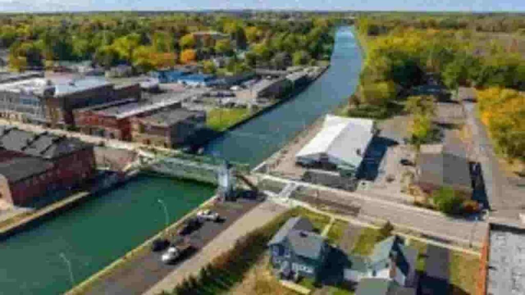
GIS Map & Regional Overview
This county in western New York covers approximately 817 square miles, including land and water areas. Population is estimated around 40,000, with moderate housing demand. GIS mapping tools display parcel boundaries, zoning layers, and ownership data clearly for users.
- Total area: 533 sq. miles
- Land area: 817 sq. miles
- Water area: 426 sq. miles
- Median home value: $150,000
- Population: 40,000
Nearby Counties
Key Cities & Parcel Distribution
Albion
4,163 Parcels

Medina
3,025 parcels

3833 Parcels
Property Search Tool – 4 Easy Ways
The Orleans County property search system allows fast and free access to public records. Users can retrieve ownership, tax, and parcel-level data using simple search filters. The tool is designed for quick navigation and accurate results.
Search By Owner Name
Search using the owner’s full or partial name to locate property records. This method helps identify ownership details, linked parcels, and tax data across Orleans County property databases with accurate and updated information.
Search By Address
Enter a complete property address to access parcel details instantly. This includes ownership records, tax history, and valuation data. It is the fastest method when exact location details are available within the county system.
Search By Parcel PIN
Parcel Identification Number provides the most accurate search results. This unique code helps users directly access property records, tax information, and land details without confusion or duplicate entries.
Search By City Name
If detailed information is unavailable, search by city name to browse multiple records. This method helps users explore properties within towns and communities across the region efficiently.
Property Records Information Access
The property search platform provides complete real estate insights. Users can view ownership details, parcel values, tax records, zoning classification, and property history. This ensures informed decisions and reliable property research across Orleans County databases.
Parcel PIN
Parcel Identification Number is a unique code assigned to each property in Orleans County systems. It allows users to quickly locate accurate records, ownership details, and tax information while ensuring each parcel remains uniquely identified within the database.
Owner Address
Owner address represents the official mailing location of the property holder. It helps verify ownership records and ensures transparency when reviewing parcel data, especially when owners reside outside Orleans County or maintain multiple property holdings.
Administration Code
Administration code is used internally for managing parcel records within county systems. It supports classification, taxation processes, and efficient record tracking, ensuring accurate handling of property data and streamlined administrative operations.
Owner Identity
Owner identity displays the legally registered property holder name. It helps confirm ownership rights and allows users to verify who currently owns a parcel within Orleans County public property records.
Legal Identification
Legal identification contains the official property description used in legal documents. It defines boundaries and location precisely, ensuring clarity in ownership, transactions, and land registration records within the county system.
Tax Parcel Use Code
These codes classify how a property is used, such as residential, commercial, or agricultural. They help determine tax rates and provide insight into land usage patterns across Orleans County.
Zoning Code
Zoning code defines land-use regulations applied to each parcel. It helps users understand development permissions, restrictions, and planning guidelines enforced across different areas within the county.
GIS Acres
GIS acreage represents the total land size calculated using mapping technology. It provides accurate measurements of parcel dimensions and helps users evaluate property size using geographic data systems.
Construction Date
Construction year indicates when the primary structure was built. This helps estimate building age, condition, and potential maintenance needs for buyers and property analysts.
Gross Living Area
Gross living area measures the total interior usable space within a property. It is a key factor in property valuation and helps compare residential units effectively.
Building Code
Building code defines the classification and standards applied to structures. It ensures compliance with safety regulations and helps categorize buildings based on construction type and usage.
Water Supply
Water supply information identifies whether the property uses public water systems or private wells. It is essential for understanding utility access and infrastructure availability within Orleans County.
Sewerage System
Sewerage system explains how waste disposal is managed, whether through public sewer lines or septic systems. This information is important for maintenance planning and environmental compliance.
Property Valuation Date
Property valuation data provides a breakdown of assessed values, including land and improvements. It helps users understand how total property value is calculated for taxation purposes.
Net Assessed Land Value
Net assessed land value reflects the taxable value of land only, excluding buildings. It forms the base for property tax calculations and helps evaluate raw land worth accurately.
Full Site Address
Full site address provides the exact physical location of a property. It includes street name, number, and locality, helping users easily identify and verify parcel locations within Orleans County mapping systems.
Mailing Address
Mailing address shows where official tax bills and property documents are sent. It may differ from the property location, especially when owners live in different cities or states.
Site Address Zip
ZIP code identifies the postal region of a property location. It improves search accuracy, supports geographic filtering, and ensures correct identification of parcels within Orleans County systems.
Orleans County, NY Property Tax & Community Data
Community-level property and tax insights across Orleans County, New York. This dataset includes estimated parcels, population, land area, preliminary millage rates, and median property tax bills for accurate property analysis and local tax understanding.
| City / Community Name | Parent Municipality | Total Parcels (Est.) | Total Population (2026) | Area (Sq Mi) | Preliminary Millage Rate (2026) | Median Tax Bill (Est.) |
|---|---|---|---|---|---|---|
| Albion (Town) | Town of Albion | 3,350 | 7,954 | 25.0 | 8.05 | $3,520 |
| Ridgeway | Town of Ridgeway | 2,950 | 6,479 | 50.0 | 8.05 | $3,180 |
| Medina (Village) | Village of Medina | 2,400 | 5,862 | 3.0 | 8.05 | $3,450 |
| Shelby | Town of Shelby | 2,100 | 4,809 | 46.0 | 8.05 | $2,950 |
| Murray | Town of Murray | 2,150 | 4,737 | 31.0 | 8.05 | $3,010 |
| Clarendon | Town of Clarendon | 1,500 | 3,341 | 35.0 | 8.05 | $3,240 |
| Gaines | Town of Gaines | 1,450 | 3,201 | 34.0 | 8.05 | $3,120 |
| Carlton | Town of Carlton | 2,300 | 2,828 | 44.0 | 8.05 | $3,680 |
| Kendall | Town of Kendall | 1,350 | 2,590 | 33.0 | 8.05 | $3,210 |
| Yates | Town of Yates | 1,400 | 2,521 | 37.0 | 8.05 | $3,050 |
| Barre | Town of Barre | 1,050 | 1,818 | 55.0 | 8.05 | $2,890 |
| Holley (Village) | Village of Holley | 750 | 1,708 | 1.0 | 8.05 | $2,980 |
| Lyndonville (Village) | Village of Lyndonville | 400 | 770 | 1.0 | 8.05 | $2,740 |
FAQs
How can I perform an Orleans County property tax search by address?
You can complete an Orleans County property tax search by address by entering the full property location into the county’s official system. This provides tax bills, assessment values, payment history, and parcel details instantly.
Is there a free Orleans County New York property search available?
Yes, an Orleans County New York property search free tool is available online. Users can access ownership records, parcel data, tax information, and assessment details without any cost through public real property databases.
How do I use the Orleans County real property search by address tool?
The Orleans County real property search by address tool allows users to input a complete address and retrieve detailed records. This includes ownership information, land value, building details, and property tax data in one place.
Where can I find the Orleans County New York property search map?
The Orleans County New York property search map is accessible through the GIS system. It displays parcel boundaries, zoning layers, and property locations, helping users visually explore land records and geographic details.
How can I access Orleans County Clerk online records and property owner search?
The Orleans County Clerk online records system provides access to deeds, mortgages, and legal documents. You can combine this with an Orleans County New York property search by owner to verify ownership and review official property records.